
Stanislaus County ZIP Code Directory Coverage
Stanislaus County has nine incorporated cities: Modesto, Ceres, Turlock, Riverbank, Oakdale, Patterson, Newman, Hughson, and Waterford. Extensive unincorporated communities sit between and around them. Postal service areas do not line up neatly with those jurisdictions, so the coverage table separates a postal name from a legal location. The locality descriptions are routing aids, not boundary declarations. Core entries follow the county ZIP set surfaced in the California Department of Health Care Services PACE document, with fringe rows flagged for parcel-level checks.
| ZIP | Areas Covered | Post Office | Notes |
|---|---|---|---|
| 95304 | West county edge, rural Tracy-Patterson vicinity | Tracy | Cross-county border ZIP; verify parcel county. |
| 95307 | Ceres | Ceres | City and nearby unincorporated delivery area. |
| 95313 | Crows Landing | Crows Landing | Rural west and south county. |
| 95316 | Denair | Denair | Unincorporated community east of Turlock. |
| 95319 | Empire | Empire | Unincorporated community east of Modesto. |
| 95323 | Hickman | Hickman | Rural and unincorporated east county. |
| 95326 | Hughson | Hughson | City plus surrounding rural routes. |
| 95328 | Keyes | Keyes | Unincorporated community between Ceres and Turlock. |
| 95329 | La Grange vicinity | La Grange | Rural foothill and border geography; verify each parcel. |
| 95350 | North and central Modesto | Modesto | Delivery area, not identical to city limits. |
| 95351 | South and west Modesto | Modesto | Includes unincorporated South Modesto pockets. |
| 95352 | Modesto PO boxes | Modesto | PO-box ZIP; no street-neighbor geography. |
| 95353 | Modesto institutional or unique mail | Modesto | Verify the exact addressee through USPS. |
| 95354 | Downtown and east-central Modesto | Modesto | County offices and the Recorder area use this postal code. |
| 95355 | East and northeast Modesto | Modesto | Postal boundary does not establish incorporation. |
| 95356 | Northwest Modesto | Modesto | Developed and fringe areas. |
| 95357 | East and southeast Modesto, rural routes | Modesto | Broad rural delivery footprint. |
| 95358 | Southwest and rural Modesto | Modesto | County Public Works uses this ZIP. |
| 95360 | Newman | Newman | Southwestern county city and rural routes. |
| 95361 | Oakdale | Oakdale | City and extensive rural or foothill delivery area. |
| 95363 | Patterson | Patterson | West-county city and rural routes. |
| 95367 | Riverbank | Riverbank | City and surrounding delivery area. |
| 95368 | Salida | Salida | Unincorporated community northwest of Modesto. |
| 95380 | Central and south Turlock | Turlock | City and surrounding routes. |
| 95381 | Turlock PO boxes | Turlock | PO-box-only ZIP; no street-neighbor geography. |
| 95382 | North and east Turlock | Turlock | Includes the CSU Stanislaus vicinity. |
| 95385 | Vernalis vicinity | Vernalis | Rural west edge; verify county and border parcel. |
| 95386 | Waterford | Waterford | City and east-county rural routes. |
| 95387 | Westley | Westley | Rural Interstate 5 corridor. |
Most rows are city or community delivery areas, but rural routes can extend beyond a named place. The Modesto run from 95350 through 95358 includes developed areas, county islands, and South Modesto pockets. The Turlock rows include a PO-box code, while 95353 needs exact addressee verification because it serves institutional or unique mail. The west-edge entries 95304, 95329, and 95385 deserve extra care where county lines are close. The California DHCS PACE ZIP document is useful corroboration, but USPS and GIS decide an individual address.
Stanislaus County Postal Geography
A USPS city name is a preferred mail label. It is not a municipal corporation and it does not prove that a parcel sits inside city limits. A Modesto mailing address can reach an unincorporated South Modesto pocket or another county island. The same rule applies beyond the county seat: a Ceres, Turlock, Oakdale, Patterson, Riverbank, Newman, Waterford, or Hughson postal label can serve nearby rural routes. The correct custodian follows the parcel and the service jurisdiction, not the name printed beside the ZIP.
County GIS layers help separate incorporated boundaries, annexations, county islands, parcels, and other district context. For unincorporated road or land-development questions, Stanislaus County Public Works lists its office at 1716 Morgan Road, Modesto, California 95358, with phone 209-525-4130 and weekday hours of 8:00 to 5:00. Incorporated city planning or engineering offices validate local addresses within their own limits. A ZIP can start the route, but the parcel map should finish it.
Confirm a Stanislaus County ZIP
The USPS ZIP Code Lookup accepts a street address, city and state, or ZIP information and returns a standardized mailing result. Its role is address validation for delivery. It does not report a parcel owner or government jurisdiction. That distinction makes USPS the first check for spelling and postal format, not the last check for a resident, an owner, or a city boundary.
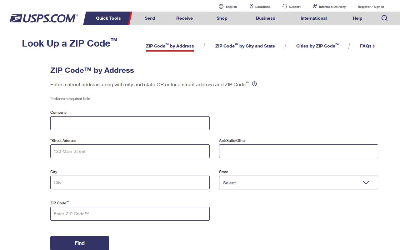
The standardized result can be saved beside the assessor situs address and the deed legal description. That three-part record prevents a postal label from being mistaken for a parcel key. It also gives later searches a clean way to compare a current address with an older street spelling or number.
Fringe ZIPs need extra care. The 95304 Tracy-area row and 95329 La Grange row sit near border geography, while 95385 includes rural west-edge locations that should be checked parcel by parcel. USPS can validate the mail route, but only GIS and the relevant county or city office can resolve the governing jurisdiction.
Find Stanislaus County Residents by ZIP
A ZIP-wide resident list is not supplied by the main county portals. The free Assessor Public Inquiry path starts with an APN, RecorderWorks searches names, documents, dates, APNs, and legal descriptions rather than a ZIP filter, and the GIS viewer supplies geography rather than a household roll. The California voter status tool is for a voter to check their own record. Use a ZIP as a narrowing clue, then move to the record type that can actually answer the question.
- Choose the postal area. Start with one ZIP from the coverage table and keep its post-office name and any fringe, PO-box, or unique-mail note beside the search.
- Check the map. Use the Stanislaus County GIS open-data hub or the county parcel viewer to compare the address with parcels, city limits, annexations, and county islands.
- Find the APN. Once the parcel is known, use the Assessor inquiry with the APN in
000-000-000format. Dashes are required for the public web path. - Follow the recorded trail. Search the APN, legal description, or a named party in RecorderWorks. The result is an instrument trail, not proof that the named owner lives there.
- Use voter tools only for their stated purpose. A person may use the California voter self-status tool to verify their own registration. A voter-file request is a separate restricted process and cannot be used as a casual ZIP or street directory.
After a ZIP narrows the search to a street, the Stanislaus County street directory handles the address-level walk through parcels, deeds, and related street records. The Stanislaus County ZIP code directory is a routing index, not a claim about every household in the delivery area.
Stanislaus County EMSA ZIP Search
The EMSA license verification search is an official form with a ZIP field. It can narrow an EMT or paramedic record by license type, status, name, city, county, state, or ZIP Code, with the county set to Stanislaus when appropriate. EMSA recommends using only one or two fields. A wildcard can follow known letters. A match identifies a professional license record and status, not a home, a household, or current residence.
| Field label | Type | Required | Options / format notes |
|---|---|---|---|
| License Type | selection | Not specified | Choose a license category when known. |
| License Status | selection | Not specified | Use a status filter when needed. |
| License Number | text | Not specified | Use an exact number when available. |
| First Name | text | Not specified | Known letters can be paired with the wildcard. |
| Last Name | text | Not specified | Try spelling variants when a name is uncertain. |
| City | text | Not specified | Use the reported city, not an assumed city limit. |
| County | selection | Not specified | Set to Stanislaus for a county-focused search. |
| State | selection | Not specified | California is the relevant state filter. |
| Zipcode | text | Not specified | Enter the ZIP when the license record is known to use it. |
EMSA shows why ZIP search needs a defined record type. A city or ZIP match may help distinguish two people with similar names, but it does not turn a license register into a resident directory. The California Department of Consumer Affairs License Search adds city and county filters for many boards, but its fields vary by license type and it has no general household role. Keep each license result tied to its own source and confirm any address question through parcel or official contact records.
Stanislaus County Parcel and ZIP Limits
A postal area becomes useful for property research only after it is tied to an APN. The free Stanislaus County Assessor data service Public Inquiry path requires the disclaimer and an APN in 000-000-000 format. It does not provide a free owner-name search on the web. Public self-service computers at the Assessor office expose assessment data, while the broader Online Agency Inquiry can search Parcel Number, Name, and Situs or address for registered users who demonstrate a business need. That service costs $300 per year and requires registration, a signed agreement, and login credentials.
The Assessor is at 1010 10th Street, Suite 2400, Modesto, California 95354, phone 209-525-6461, Monday through Friday from 8:00 to 4:30. A situs address describes where the land or building is located. A mailing address is where tax correspondence goes. The two can differ, and neither one alone proves who lives at the property. GIS parcel shapes show geography, but assessment data must be joined separately; the map is informational, not a boundary survey.
Note: A different mailing address may suggest absentee ownership, but it never proves who lives at the parcel.
Preserve Stanislaus County Address Forms
Keep three forms of an address together during a ZIP search: the standardized USPS mailing address, the Assessor situs address, and the deed's legal description with its APN. The situs is the physical location used by the assessment record. The legal description identifies the land in a recorded instrument, even when postal wording changes. An APN identifies a tax parcel, not a delivery route, and it can change after a parcel split or merge without moving the building.
USPS address → GIS jurisdiction → APN → Assessor record → RecorderWorks instrument
Annexation can move an address from county permitting to city permitting while its postal city stays the same. A parcel split can create a new APN. A permit can date construction or alteration, but it does not name every occupant. Historical reverse or criss-cross directories should be searched under the street spelling and number printed in that publication year, then compared with the legal description and map context.
Stanislaus County ZIP Terms
Postal records use short terms that can sound like land terms. The distinctions below keep a delivery code from being read as a parcel, a city boundary, or a household count.
- ZIP code
- A five-digit USPS delivery identifier. Its preferred city name guides mail routing and does not establish city limits.
- ZIP+4
- An added four-digit delivery detail that refines the postal destination. It is not an APN, legal description, or proof of occupancy.
- PO-box ZIP
- A ZIP used for post-office boxes rather than a street delivery area. It does not describe street neighbors or parcel geography.
- Unique ZIP
- A code assigned to an institution or specialized mail destination. The 95353 Modesto entry is treated as institutional or unique mail and needs addressee verification.
- Carrier route
- A group of delivery points served along a carrier's route. It supports mail operations, not a legal parcel boundary or resident roll.
The 95352 Modesto and 95381 Turlock entries are PO-box ZIPs. The 95353 entry is institutional or unique. Those three rows should never be used to infer a street block. A ZIP+4 can make a mailing address more precise, but only the parcel and deed keys can support land-record research.
Stanislaus County Modesto ZIPs
Modesto postal geography has several useful local clues. The 95350 and 95351 rows describe north, central, south, and west delivery areas. The 95354 row covers downtown and east-central mail, including the county office area. The 95355 and 95356 rows reach east, northeast, and northwest areas, while 95357 and 95358 extend toward rural and fringe routes. These labels help sort a search, but they do not turn the whole 95350-95358 run into one city boundary.
South Modesto is the clearest local reminder. A Modesto postal label can be attached to a county island or unincorporated pocket, so the appropriate permit, clerk, planning, or public-record channel may be a county office rather than the City of Modesto. A family directory, deed, or newspaper can preserve the postal name even when the legal jurisdiction is different. Use the parcel map and the address-era record together.
Stanislaus County ZIP Research Limits
When an online portal lacks a ZIP filter, the California Public Records Act, Government Code sections 7920.000 through 7931.000, is a fallback for an identifiable existing county or city record. A useful request names the address or ZIP, date range, department, record type, spelling variants, and preferred electronic format. It should ask for records already held, not require an office to create a new list of residents. Jurisdiction should be resolved first so the request reaches the office that serves the parcel.
Privacy limits remain part of the search design. The voter self-status tool authenticates an individual and is not a public name-and-address directory. Released voter files require an authorized purpose, exclude confidential registrants, and omit protected identifiers. A parcel result, an EMSA license hit, or a voter-file row each has a different meaning. The Stanislaus County postal directory should keep the ZIP clue beside the legal location, not expand it into a household claim without source-level proof.