
Looking Up Stanislaus County Neighbors
A block lookup is a layered records task. The parcel map supplies the shape of the block, the Assessor connects an APN to property data, and the Recorder preserves instruments tied to each parcel. Permits and environmental records can mark activity at a location. A civic roster can show who represents an unincorporated community. Historical directories can add older occupants. Those sources answer different questions, so a useful Stanislaus County neighbors search keeps ownership, occupancy, civic service, and past residence in separate columns.
| Source | What It Shows About a Block | Access |
|---|---|---|
| County GIS Central and open-data layers | Parcel outlines, APNs, address points, jurisdiction layers, and the pattern of nearby parcels | Free public viewer and data hub; geometry does not include ownership by itself |
| Assessor Public Inquiry and public kiosks | Assessment data, situs address, values, characteristics, and parcel-level clues about titled ownership | Free APN web inquiry; broader public fields are available at the Modesto office kiosks |
| RecorderWorks official-record index | Deeds, liens, maps, releases, document dates, and named parties for each neighboring APN | Free index from 1850 to the present; copies and images follow the Recorder’s order process |
| Stanislaus County Accela permit search | Address, parcel, record, and licensed-professional history for county-jurisdiction work | Public search; incorporated-city coverage can sit in a separate city system |
| Authorized California voter file | Registration residence and precinct information for an approved statutory purpose | Formal application and use limits; not a casual block list |
| Municipal Advisory Council and public-board rosters | Appointed civic contacts and meeting roles for named communities | Public roster through county board materials; not a household or membership directory |
| Historical reverse directories | Listed occupants or businesses at an address in a particular printed year | Stanislaus Library Special Collections and other local-history holdings, in person |
Parcel and deed records are strongest for land and recorded transactions. They do not list every non-owner occupant, child, roommate, guest, or household member. A civic roster names public representatives, not every person in the community. No authoritative countywide HOA member inventory was located, and private groups may choose to forward a message instead of releasing contacts.
When an online result is thin, the Assessor’s public kiosk at 1010 10th Street, Suite 2400, and the Clerk-Recorder counter at 1021 I Street, Suite 101, provide in-person fallbacks. The Assessor’s public line is 209-525-6461; the Recorder’s records-help line is 209-525-5279. A California Public Records Act request can identify an existing county administrative record, but it does not require an office to create a list of Stanislaus County neighbors.
Map a Stanislaus County Block by APN
The adjacent-parcel method starts with one known address and keeps every parcel separate. Stanislaus County GIS shows geometry and surrounding land, while the Assessor and Recorder supply different kinds of record detail. Shared boundaries, corner lots, rear parcels, and parcels across a road should be marked as distinct relationships. A map view can suggest which records belong together, but it cannot turn a visual cluster into a list of households.
- Write down the seed address exactly as known, including its postal city, and note that a postal label such as Modesto does not settle city versus unincorporated jurisdiction.
- Open the county parcel viewer or open-data layers, use the address search when available, then zoom and pan until the subject parcel and its boundaries are clear.
- Record the seed APN, note parcels that share a boundary, and separately mark across-street parcels, corner parcels, and rear-lot parcels that may look close but do not share the same legal edge.
- Run each APN through the Assessor inquiry. The free web path expects a parcel number in the county format, while the public Modesto kiosks expose broader assessment fields.
- Search each APN in RecorderWorks, preserve the document number and party role, and keep a separate note for each parcel instead of merging similar names.
- Use permits, historical directories, or civic sources only as added context. Label each clue by date and source before drawing a conclusion about the block.
A whole named street needs a wider address chain than a block map. The Stanislaus County street directory workflow is the better fit when the question expands from immediate neighbors to every parcel along a street.
Stanislaus County Frontage and Neighbor Parcels
“Nearby” has more than one meaning in Stanislaus County. A frontage parcel may share a side boundary with the seed lot, while a rear parcel may be reached by an alley or a narrow access strip. A corner parcel can touch two streets. An across-street parcel may be the nearest visible home but share no boundary at all. Record the relationship you observed rather than calling every visible structure an adjacent parcel.
The county’s GIS open-data hub and public layers can add city limits, annexations, county islands, districts, transportation, river, and fire-district context around a parcel. The county’s redistricting map instructions illustrate the ArcGIS habits used for public map work, including finding an address, zooming, panning, and drawing a boundary. Those tools help define a study area. They do not replace a survey, a recorded map, or a title review.
Open-data parcel shapes are geometry. Ownership must be obtained from a separate Assessor channel and then checked against the Recorder’s documents. That separation matters when a block contains a split parcel, a merged parcel, a public tract, or an entity-owned property. The map tells you which APNs to examine; it does not tell you which people share a home.
Stanislaus County Neighbor Address Clues
The Assessor distinguishes the situs address from the mailing address. Situs is the physical property location used for the assessed parcel. Mailing is where the owner or assessee asks for tax correspondence. In Stanislaus County, a mismatch can reflect an absentee owner, trust or entity routing, a mailing agent, or a simple preference. Matching addresses can support an owner-occupancy hypothesis, but neither match proves who currently lives at the property.
The free Public Inquiry uses a Parcel Number text field in the county format with dashes, such as 000-000-000, after the user accepts the disclaimer. A Name search is not exposed in that free web path. Broader name and situs searching is available through public office kiosks or the restricted service, while the free web route remains APN-first.
The public kiosk channel is at the Assessor’s office at 1010 10th Street, Suite 2400, Modesto, during the documented Monday through Friday, 8:00 a.m. to 4:30 p.m. hours. The restricted Online Agency Inquiry is described as a $300 annual service with a login, user agreement, and demonstrated business need. Those access paths explain why a parcel-first workflow is practical for Stanislaus County neighbors.
- Parcel
- A mapped unit of land tracked by an APN for assessment and related records.
- APN
- The Assessor’s parcel number, used as the cross-system key when an address or name is not enough.
- Situs address
- The physical location of the assessed property, distinct from a tax-mailing address.
- Legal description
- The recorded land description that can bridge an old address, map, or street label to the correct parcel.
A homeowners’ exemption may support an owner’s principal-residence claim, yet it is not a complete household roster. Treat it as one clue beside the APN, deed, dates, and parcel history.
Stanislaus County Neighbor Deed Trails
RecorderWorks is most useful after the map has supplied individual APNs. The Stanislaus County RecorderWorks index states coverage from January 1, 1850 to the present and supports name, document, map, book-and-page, recording-date, parcel, and legal-description modes. Search the same APN separately for each parcel, then use the document detail to distinguish a deed, lien, release, map, or other instrument.
A current deed can connect a recorded grantee to a parcel. A deed of trust is a security instrument, not the same thing as an ownership transfer. A trust or business entity may appear instead of a person. The indexed party is evidence that the party appeared in an instrument; it is not proof that the party lived at the address. Preserve the recording date, document number, legal description, and party role before comparing one parcel with another.
The strongest local flow is seed address → APN → parcel record → recorded instrument → named party → separate corroborating clue. RecorderWorks also lets a researcher select an indexed name and retrieve documents connected to that name, sorted by document type and recording date. That click-through can help build a chain, but same-name people still require dates, co-parties, APNs, and legal descriptions.
Note: RecorderWorks states an 1850 index start even though Stanislaus County organized in 1854, so inspect each result’s jurisdiction and document date.
Stanislaus County Voter Block Limits
California’s voter status service is designed for a voter to check their own registration, not for someone to enumerate nearby households. The identity form uses first name, last name, date of birth, and either a California driver license or ID number, the last four numbers of a Social Security number, or the available “I do not have” path. A successful personal result can show registration status, party and language preference, vote-by-mail or provisional-ballot information, polling place, election details, county contact, and voter-guide delivery preference.
The statewide file is a different access channel. An approved requester may apply for a file for election, scholarly, journalistic, political, or qualifying governmental purposes. California Elections Code section 2194 controls those uses, and Government Code section 7924.000 protects specified home-address, telephone, email, identifier, and signature fields. Confidential registrants are excluded except for narrow authorized access. A public voter result cannot establish the members of a household or prove that a nearby address is occupied by a named person.
The California Secretary of State voter self-status tool shows how narrowly a public lookup should be designed: the person supplies identity details to view a personal registration result.
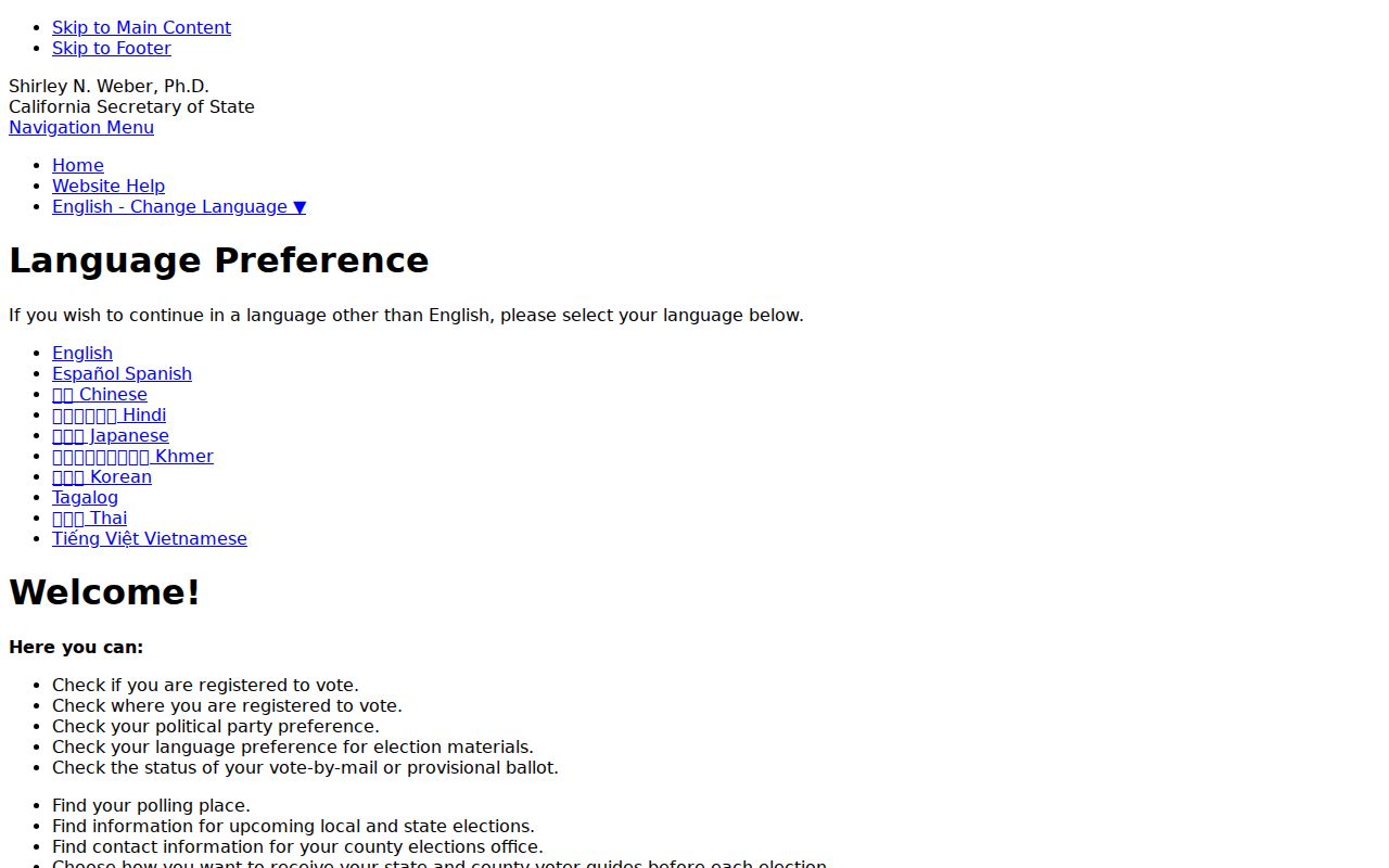
Its identity fields and personal-result screen make the boundary clear. The tool can answer a voter’s own status question, but it cannot serve as proof of who lives next door.
For an approved-purpose request, use the California voter-file application instructions and follow the stated security and use rules. For ordinary personal research, keep voter information out of a block list and rely on parcel, deed, historical, or civic records that fit the question.
Stanislaus County Civic Neighbors and Contacts
Community contacts can add a human and civic layer without exposing a household list. Stanislaus County’s Municipal Advisory Councils cover Denair, Empire, Hickman, Keyes, Knights Ferry, Salida, South Modesto, Valley Home, and Wood Colony. Their public role is to advise on health, safety, welfare, public works, and planning for unincorporated communities. A roster can identify an appointed representative or meeting contact. It does not identify every resident, member, or nearby homeowner.
| Community layer | Area or role | Public contact path |
|---|---|---|
| Municipal Advisory Councils | Denair, Empire, Hickman, Keyes, Knights Ferry, Salida, South Modesto, Valley Home, and Wood Colony | County Boards and Commissions fact sheets and rosters; verify active status before relying on a listing |
| Modesto public boards and commissions | Incorporated Modesto civic appointments | City appointment and meeting information; public officials and applicants, not neighborhood households |
| Neighborhood associations and HOAs | Individual subdivisions or voluntary groups | No authoritative countywide member inventory was located; ask an association to forward a message |
| Congregations, watch groups, and private clubs | Voluntary community ties | Contact the organization directly; private rosters should not be treated as public records |
The county’s official Boards and Commissions materials are useful for civic routing. They help answer “who represents this unincorporated community?” rather than “who lives in every house?” That distinction keeps public contact information useful without turning it into a personal directory.
Stanislaus County Block Activity Clues
A nearby establishment can explain why a block appears in a public record without identifying a resident. Stanislaus County Environmental Health records include food-facility inspection searches by facility name, street name, or city. The program’s broader work includes restaurants, markets, mobile vendors, temporary events, cottage-food operations, pools and spas, wells, septic systems, small public water systems, and body-art facilities. A facility result can date activity at an address, but the facility name is not an occupant roll.
Pair a facility clue with a filed fictitious business name, a California Secretary of State entity filing, or a relevant professional license. A FBN connects a trade name to registrants, while an entity filing can show officers, managers, agents, status, and filing addresses. The county Environmental Health program and California bizfile business search describe different records. An agent address or business mailing address is not proof that an owner or registrant lives at the premises.
That separation is especially useful on mixed residential and commercial blocks in Modesto, Turlock, Ceres, and unincorporated communities. Label the result as an establishment, licensee, registrant, or property party. Do not replace that label with “neighbor” unless an independent source supports the description.
Official Rolls Versus Commercial Neighbor Categories
Commercial neighbor categories often combine public records with purchased data and older address files. They may be convenient for broad discovery, but they do not change the meaning of the source record. Official Stanislaus County channels also have gaps, yet their custodian, record type, date, and access limits can be checked directly.
| Official record route | Commercial category | Why the distinction matters |
|---|---|---|
| GIS parcel geometry and APN | Compiled address profile | The county map shows land shape and parcel identity; a compiled profile may join an old address to the wrong person. |
| Assessor or Recorder record | Owner or occupant summary | The official record states its role and date; a summary can blur owner, mailing recipient, and occupant. |
| Public civic roster | Community or household label | A civic appointment is public service information, not proof of membership or residence for every nearby home. |
| Historical directory or newspaper | Estimated current neighbor match | A dated source can explain past context; an estimate may be stale, merged, or unsupported by the original record. |
Use the official source when the date, parcel, document, or civic role matters. If a commercial result conflicts with a custodian record, preserve the original record details and ask the responsible office about a correction rather than repeating the compiled claim.
Stanislaus County Memory of a Block
Modern parcel work can miss a block whose street label, jurisdiction, or building pattern changed. Stanislaus County moved its county seat from Adamsville to Empire City, La Grange, Knights Ferry, and finally Modesto between 1854 and 1871. A family or neighborhood can stay within the broad county while its nearest courthouse, post-office label, newspaper, and directory reference changes. Old maps and legal descriptions are better bridges than assuming that a present postal city matches an older place name.
The Modesto Library Special Collections holds non-current telephone and city directories, local history, genealogy material, older high-school yearbooks, and related reference sources. A library account says directory and government material dates to 1914, but the public catalog does not publish a complete volume-by-volume run or a complete digitized Modesto criss-cross directory. Ask the Stanislaus County Library Special Collections reference staff about the exact year and street section needed; the collection is for in-library research.
The open-for-research Stanislaus County Oral History collection contains eight boxes of interviews and transcripts dated 1957 to 2006. Oral histories can supply earlier street names, family ties, clubs, and reasons a household moved after deeds and directories establish who and where. School photographs, community records, the circa-1921 Modesto map, and local newspapers can add neighborhood context, but an archival association does not become proof of a current neighbor.
Stanislaus County Neighbor Lookup Privacy
Some people are absent from a public block picture by design. California’s Safe at Home program provides a substitute mailing address and a confidential voter-registration route for eligible survivors and other protected participants. A protected address may not match a parcel record, and that mismatch should be treated as a privacy feature rather than a research error. The Safe at Home program information explains the substitute-address and confidentiality framework.
Current non-owner occupants, children, roommates, guests, utility customers, delivery recipients, and household relationships do not form a general public list. Voter home street addresses and specified identifiers are restricted. DMV residential data is protected. Recorded deeds remain public, but a recorded document still proves an instrument or land transaction, not the daily occupants of a home.
The official California Megan’s Law portal is a safety resource with statutory limits, not a neighbor directory or proof that a marker identifies a person at a nearby address.
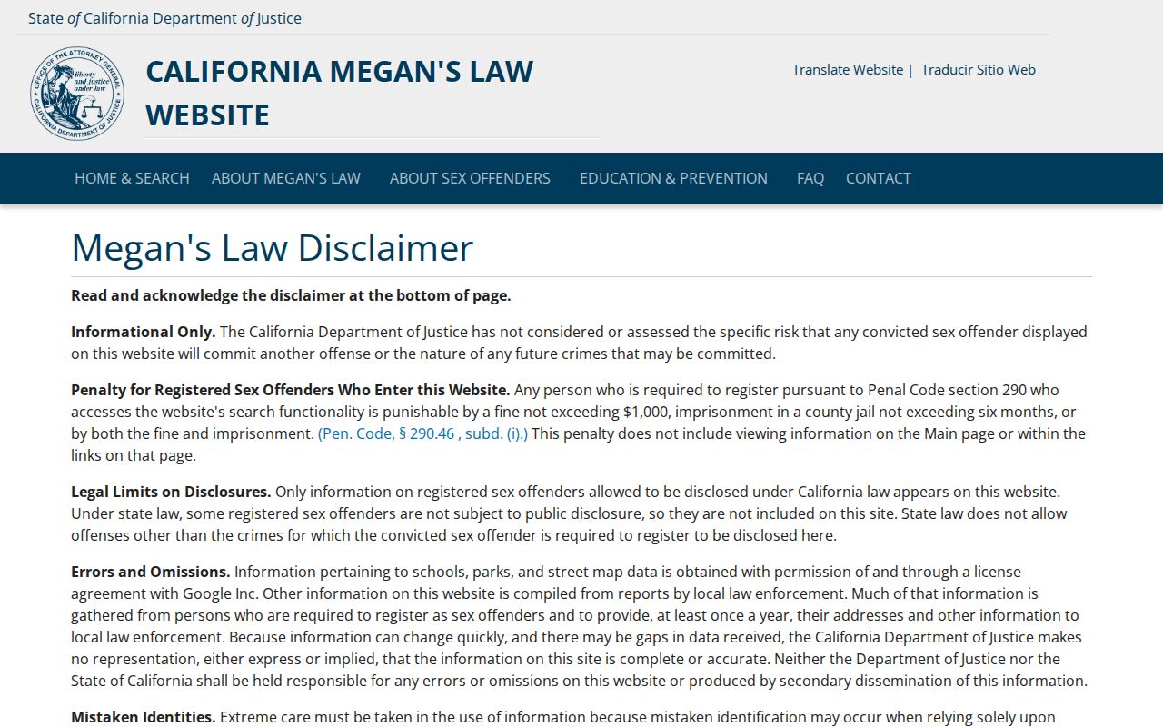
The image belongs with safety awareness only. It should never be used to label, confront, threaten, or publish a person, and it cannot fill the gap left by an owner-versus-occupant distinction.
Lawful use. Parcel and civic records can support personal history, neighborhood curiosity, family reconnection, or safety awareness. Do not use an address trail to stalk, harass, threaten, intimidate, or publish protected details.
California Penal Code section 646.9 addresses stalking, and civil anti-harassment remedies can apply to repeated conduct. A careful Stanislaus County neighbor lookup minimizes personal detail, names the source and date, and stops when the record no longer answers the legitimate question.